STUDENTS PROJECTS
PROJECTS2013

Student: Konstantinos Kosmas
Supervisor: Mr. Athanasios Spanomarides
Councelor: Mrs. Stella Pantelia
University of Patras - School of Architecture
Presentation Date: 27-02-2014
The purpose of this project is the comprehension and the reinstatement of a wounded landscape and a forsaken ancient topos (necropolis), which is located on the Livadi settlement, at the island of Aegina.
The landscape's hidden qualities and the long lost memories are revealing and emerging through a pathway that connects 6 constructs. Past and present coexist as a natural continuity in order to maintain the common memory of the landscape and the topos.
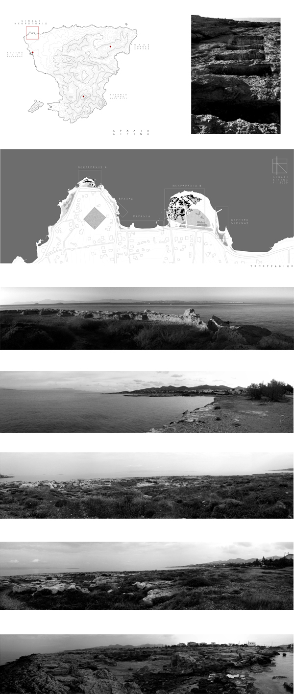
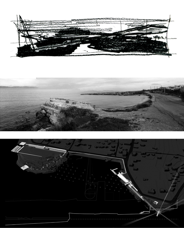
The site is located 4 km north of the island's main town, at the Livadi settlement's sea front. The project focuses on two rocky peninsulas which are connected through a narrow sandy beach.
The landscape is characterized from the rocky shoreline and the low dry vegetation.
The western peninsula's front has been heavily altered because of the constant wave that crash forcefully. On the ground's surface, cracks along with pure geometrical shapes can be seen. These forms are fragments of ancient Greek burial architecture.
At the sea bottom of the small gulf, there are traces that both peninsulas were once a part of a bigger whole and that the necropolis was much bigger.
On the eastern peninsula a sign informs about the existence of an archaeological site without further explanations. No signs of any archaeological findings can be seen from a first glance. Only through strolling at the area one can observe that there is another part of carved geometrical forms and tombs, denser and complicated than the other.
Ancient Aegeneans, were mainly traders and shipbuilders. Their huge flotilla helped them to control all sea routes of the Eastern Mediterranean sea.
Their reputation among the other city-states was poor because of their famous greed. Their alliance with the Persian Empire at the first campaign against the Greeks worsened the relationships with their fellow countrymen. The only they could do to redeem themselves from the accusation of "Medism" (Persian friend) was to fight their allies at the naval battle of Salamis with 30 warships. The Aegenean flotilla showed exceptional bravery and they were honored from the Delphic Oracle.
The dead warriors were buried at that necropolis,
Two interesting situations are happening at the selected area. The first one has to do about the altered from time, weather conditions and human activity, landscape present limits and form.
Through the extraction of stone from the sea and mainly the sea water managed to cut the rocky ground in half, submerging the central part of the necropolis.
The second one is about the topos memory. The archaeological data are not much and only through tradition, ancient stories and myths the place stays alive in people's minds. The archaeological site is totally abandoned and unknown to visitors and locals.
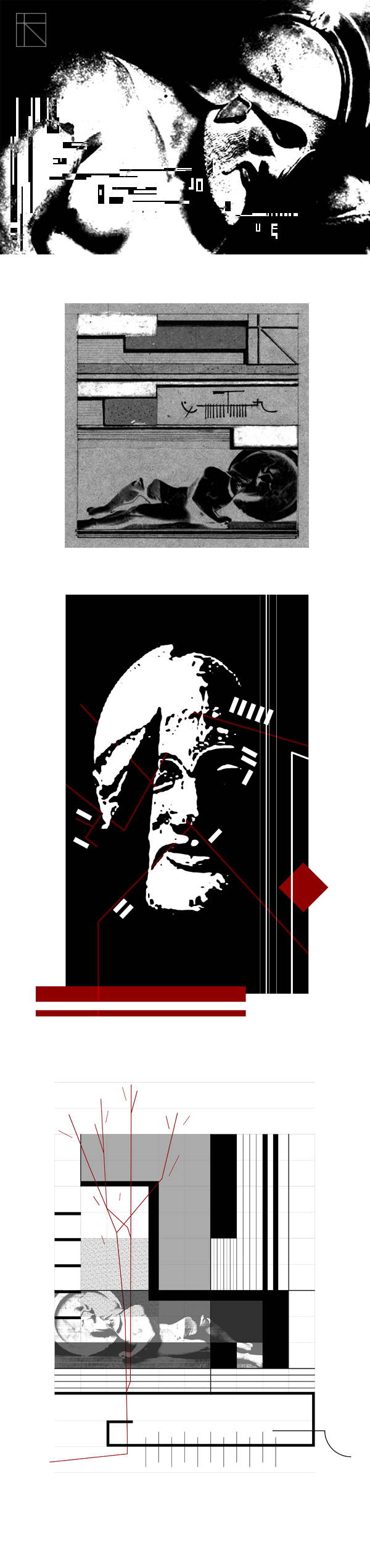
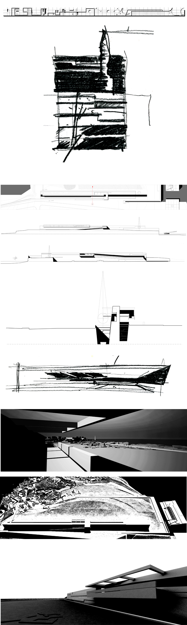
The conclusions of the landscape's data analysis seen from a "sound" point of view revealed new geometrical structures and relations. These invisible concepts return to the landscape as matter in order to create a new topos (place) which refers to the unification of the fragmented landscape and to the activation of the forsaken place's memories.
The landscape as frequencies
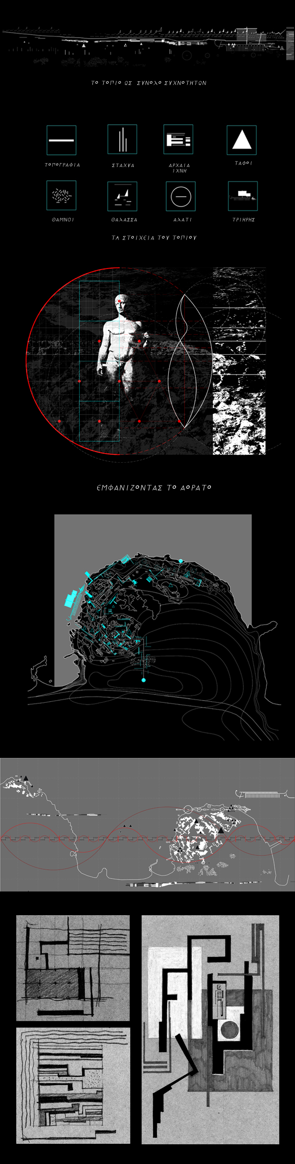
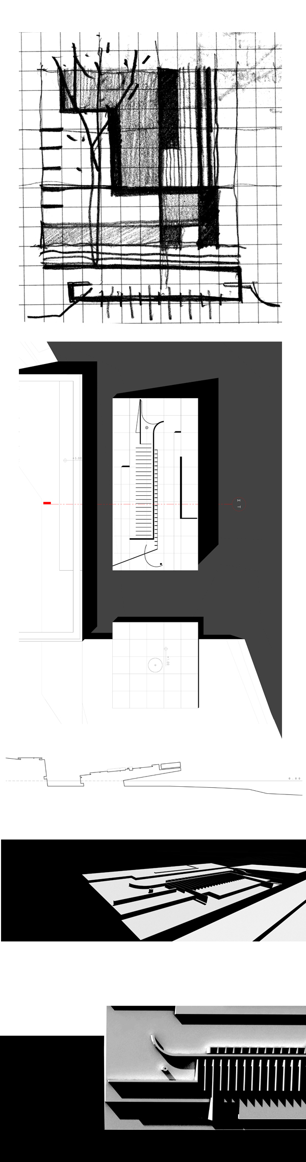
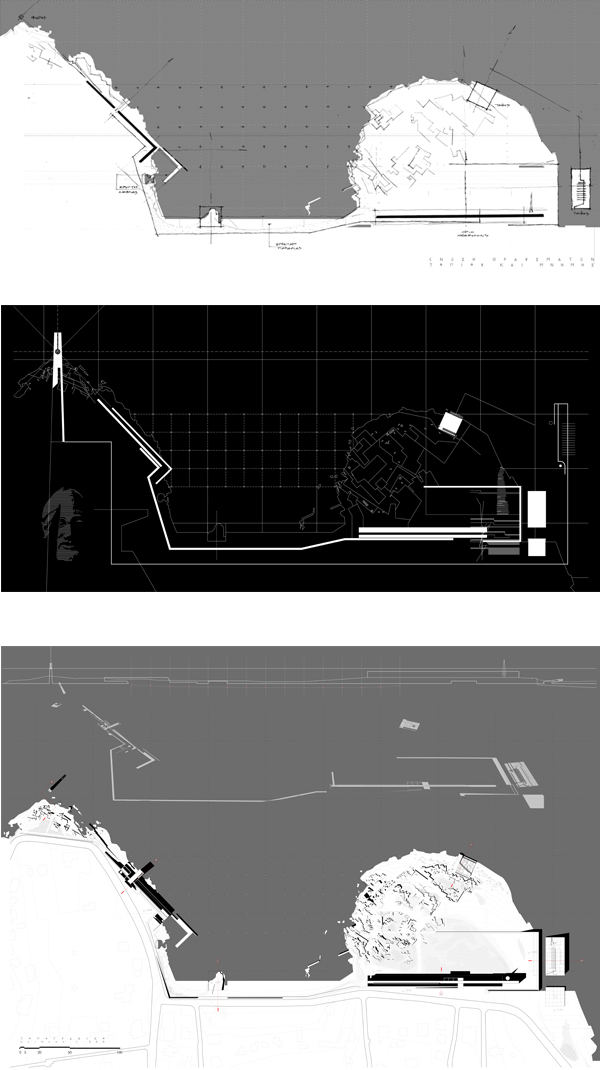
The purpose of the project is the reconnection of the peninsulas and the necropolis parts through a pathway that reveals the landscape's qualities and highlights the archaeological site. Past is been revealed to present as a natural continuity.
The landscape and memory fragments are united and redefine the public space's status through a series of 6 constructs. The archaeological site is being signified while on the same time it's a part of the landscape.
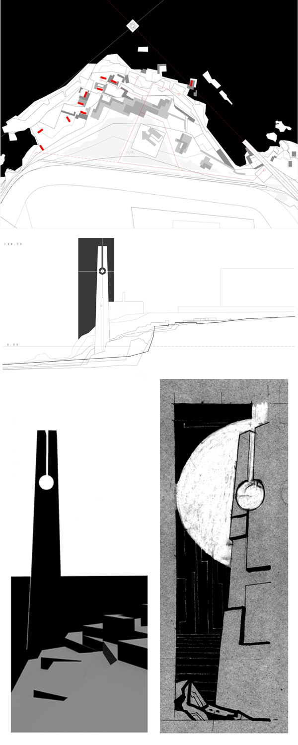
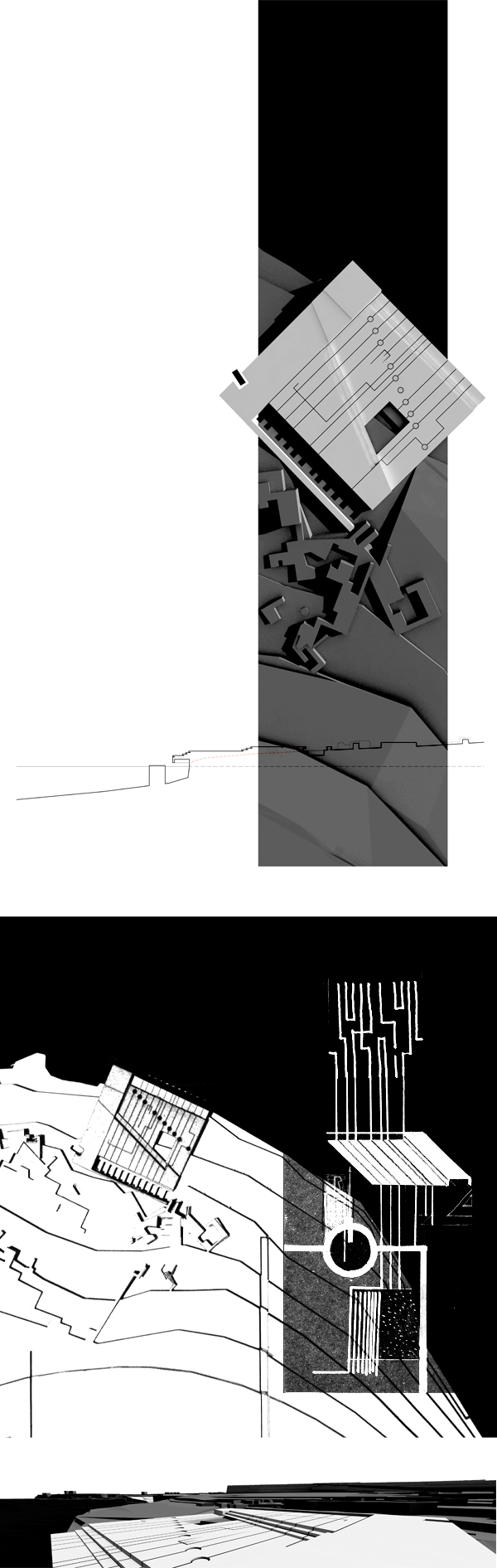
A tall lighthouse (pillar) signifies the necropolis and acts as a gateway of a new haven .At nightfall its lights point to the sites were the seafront was once extended and straight to the sky
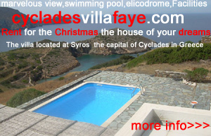
At the top of the western peninsula a new retaining wall holds the flimsy ground from further alteration and acts both as a gateway to the necropolis and as an observation point of the whole area.
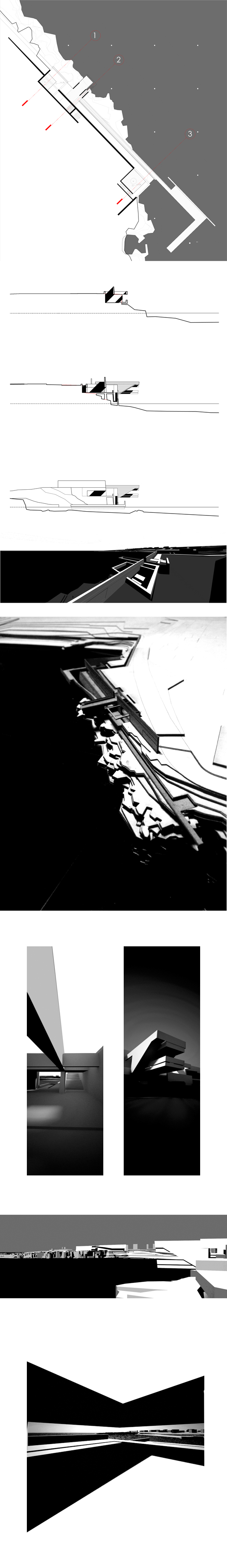
The beach's width is extended, returning the ground to a former situation. At night, the peninsulas and the necropolis are united through lights that are installed at the shallow seabed.
A moat is the new limit between the necropolis and the road.The moat reveals the section of the ground and its buried memories. A 150 x 5 x 12 m wall emerges from the moat blocking the view.
The observation point at the top of the entrance gives a generic but clear view of the necropolis layout. Then the path leads you to the ground again in order to discover from a closer point of view the ancient fragments.
At the northernmost part of the archaeological site lies a series of aligned tombs, the one next to the other along with small salt pits.
It is said that the Aegenean warriors of the Salamis battle were buried here. The tombs orientation to the nearby island and their close proximity to the sea, makes that thought stronger. A perforated plinth that delimits the tomb area is being positioned there enforcing the memory of the historical fact,
The pathway ends with a tomb for the warriors ship that acts both as a homage to the islands' naval tradition.
The trireme's tomb is slightly tilted and under the sea level. The form of the warship is being revealed through cracks and projections, allowing the water to collect in some places and to flow back again to the sea.