STUDENTS PROJECTS
PROJECTS2015
Student : Eirini Oikonomopoulou
Supervisor: Johnny Åstrand
Lund University, Sweden
Presentation date : February 2015
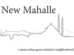
Short Description: Even though Istanbul is a modern megacity right next to Europe, bad quality neighborhoods still exist. One of them is Fener/Balat. This project aims to analyze the urban qualities of that neighborhood (mahalle) and propose a better, qualitative urban space towards a denser, greener and more inclusive neighborhood which could be an example for the whole city.
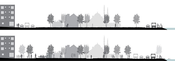
Istanbul is located in a special geographic place, just in the meeting of Europe and Asia and it has a long and great history, facts that had affected the urban form of the city. Trough the time different civilizations inhabited in the city and they changed it by giving different character to its parts. The modernization of Istanbul brought western ideas into the historic organic urban fabric and put in the first priority the need for a clear and strong car-road/highway network in order to improve the car accessibility along the city. Following that model, transformation of public spaces was based on the driving experience. New public spaces was formulated to be the new symbol of Turkish Republic, to give a beautiful and clean image of the modern Turkish city, as well as work as landmarks across the highway network.
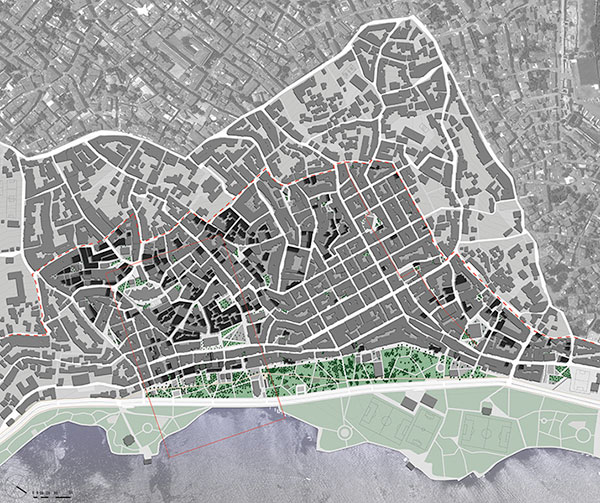
Even if city is upgraded, bad quality neighborhoods still exist, far and near to the historic city center. One of them is Fener/Balat, which is located in Fatih district on the European side of Istanbul. This project aims to analyze the urban qualities of that neighborhood (mahalle) and propose a better, qualitative urban space towards a denser, greener and more inclusive neighborhood which could be an example for the whole city.
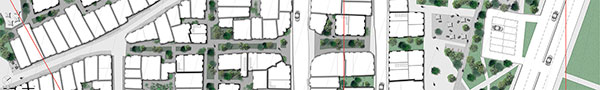
In order to upgrade the quality of urban environment, reduce the use of the car, promote walking and create a financially and socially active neighborhood all day round, street function will change and a new network will be proposed. The new network aims to give more space to pedestrians and bikers and discourage the car use inside the area.
To encourage the bike travel across the waterfront, a bike way will the designed passing it the linear park connecting the central areas (Eminönü, Karaköy etc.) and with Eyüp (funicular with great view of the city just outside Theodosian walls). Fener and Balat will be a stop along the bike way towards Eyüp for visiting historical buildings (different cultural, historical and religious buildings), have a rest in the park, eat lunch or dinner or enjoy the unique urban environment of the historic neighborhood.
As the area is part of a rehabilitation programme with collaboration of European Union and UNESCO, existing building inside the protected area should be preserved and restored. Because of the complicated ownership and the lack of central planning, the area is under poor maintenance and some buildings need excessive reparations or reconstruction. According to the proposed strategy for reparation, buildings are categorized according to their structural condition. The ones with no or limited structural reparation will be totally restored. The ones that need sever construction reparation will be kept as ruins (after the unsafe part of them are removed) and they will act as memory (as even the fact that they were left abandoned and without maintenance is a part of neighborhood's history) open spaces. On that way, the neighborhood will have enough open and green spaces with an alternative historically loaded character.
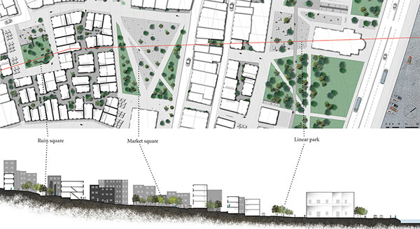
The masterplan area includes the core area of intervention, and a zone around it. A new street hierarchy is implemented based on the existing street pattern, so new blocks are formulated in order to encourage safe pedestrian and bike movements. The linear park which was located between the two lanes of Ayvansaray Street, is now connected with the city fabric and green is gradually flowing inside the urban. The linear park works as a buffer zone between the city and the busy street, and as the most public space of the area. Cultural functions are spread all over it, from museums and libraries till religious buildings, the majority of them already existing. As we walk up to the hill, public and green spaces become smaller, like small hidden corners in the dense urban area, in order to provide both privacy and public life.
The new core of the neighborhood is the market square, by Vodina Street. It is the biggest open public space in the area, a former church courtyard unused for more than hundred years. Its new functions as an open green space, which will host the weekly street market of the neighborhood and combine the new with the old buildings. The Ruin square, located northern of the Market square, is the upper corner of the former church yard, which contains the ruins of a mall church. Formulated as a small urban open space, with the ruins in the center offers a reminder of the past with an interaction with the modern city life. Public spaces and street functions are design so the more up to the hill, the more focused on privacy, so they are becoming smaller and less commercial.