STUDENTS PROJECTS
PROJECTS2013
07 May, 2014
Blurring the boundaries
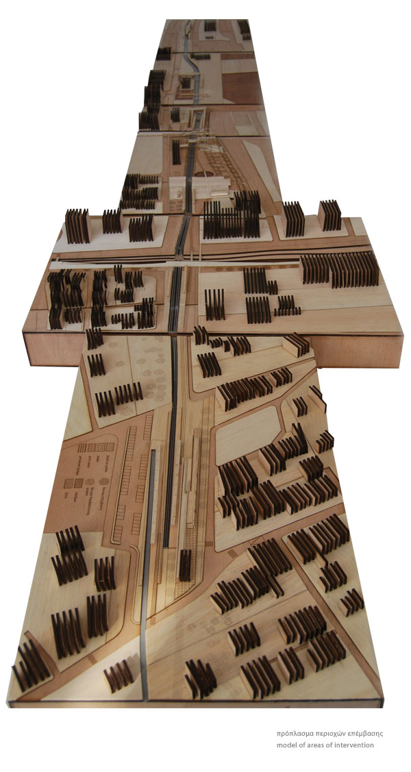
Five points of intervention along the new tram line Rio - South Port of Patras.
Students: Papamichail Theodora, Pavli Bettina
Supervisor: Panos Dragonas
Department of Architecture of University of Patras
Date of Presentation: 14th February 2013

Blurring the boundaries
Five points of intervention along the new tram line Rio - South Port of Patras
This urban design proposal refers to a new tram line connecting the suburban area of Rio with the New Port of Patras. The tram line replaces the old railway line overcoming the existing boundaries which divide the city and its waterfront. This new infrastructure gives the opportunity to create new public spaces along the tram line and reactivates the abandoned zones around the network.
"...massive or continuous single uses create urban borders. But these borders are not mere edges: they destroy neighborly relations to the point of becoming social borders. With regard to the railway, the immediate environment on either side of the tracks proves particularly dysfunctional. One side may be more dysfunctional than the other, but in any case urban life will be affected along this border"[1]
The development of infrastructure networks continuously influence and transform both the urban and the natural landscape. The networks involved in shaping a city and its suburbs, and in many cases, determine its identity. The railway networks either join or divide the city's areas, create boundaries, permeable or not, and urban voids and their function varies through time.
Abandoned or old networks can be classified as "inactive waiting points" which can produce new public spaces in cities. They are flexible structures and their creation or reactivation determines the development and transformation of the urban landscape. Furthermore, they create connections in the urban fabric, introduce new speeds, recompose the image of the city producing new "green landscapes" and redefine its position in the world map.
The evolution of the railway network
1882-1904 Construction of the railway line Patras - Athens
2004 Operation of the suburban railway line Agios Vasilios - Agios Andreas. The international railway line is transformed to a local railway line.
Operation of the Rio - Antirio bridge.
2011 Transfer of the domestic ferry routes from the North to the newly built South port of the city
South Port and Rio areas nowadays are hypertopic nodes and their connection is attempted through the new double tram line.
Analysis of the existing situation
According to the research on the areas where the new tram line is coming through, different urban characteristics and identity are obvious. Starting with the existing railway station of Rio, the tram line crosses suburban areas characterized by natural elements and leisure activities. Then it is coming through more dense areas and it is directed towards the waterfront. Finally, the tram travelling along seaside ends to the new port on the southern outskirts of the city.
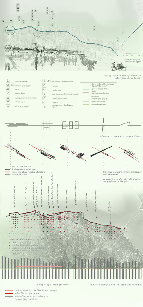
The new tram line
The design of the tram line and its stations is the result of the above analysis. The design proposal focuses on five stations of the tram line because of their key location in the city, their special characteristics or their symbolic value.
In all the areas of intervention the correlation between the typical/formal platform of the tram and the new public space is taken into consideration.
The replacement of the railway line by the new tram line gives the opportunity of manipulating the existing boundaries, like the railway line, the road network and the fencing of the North Port in the city center.
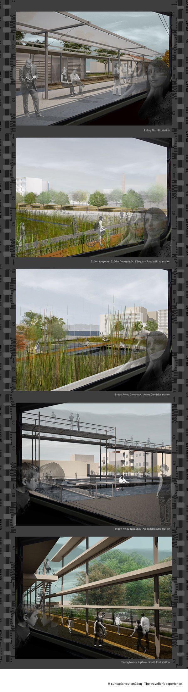
Rio Station
The existing railway station represents the cross point of the tram and railway networks. The fact that this point is the terminal of the railway and the starting point of the new tram line is crucial and determines the access to the station and the position of the train platform.

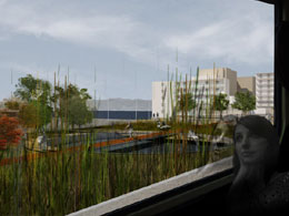
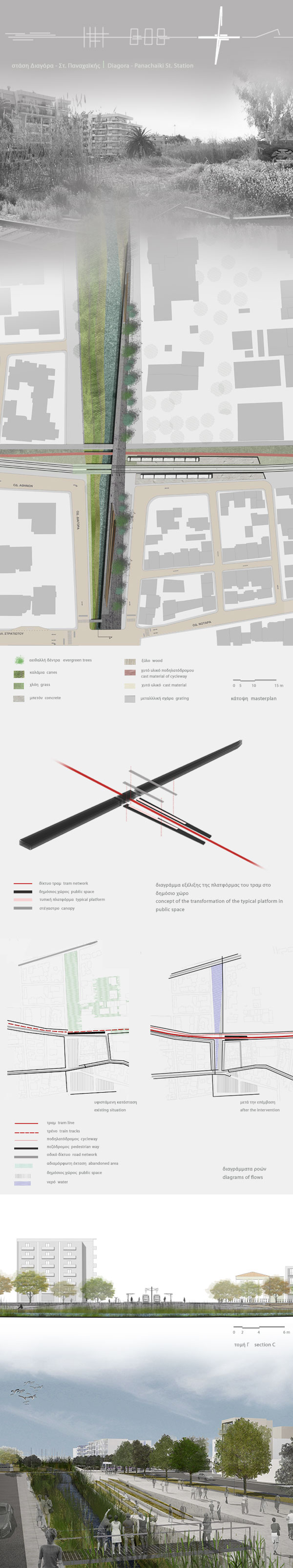
Diagora - Panachaiki stadium Station
The concept is the connection of Panachaiki stadium with the Marine of the city. The revelation of an abandoned and planted stream along the axis which connects these two areas and the development of a linear square as a new "ground" in the stream bed are the main components of the synthesis.
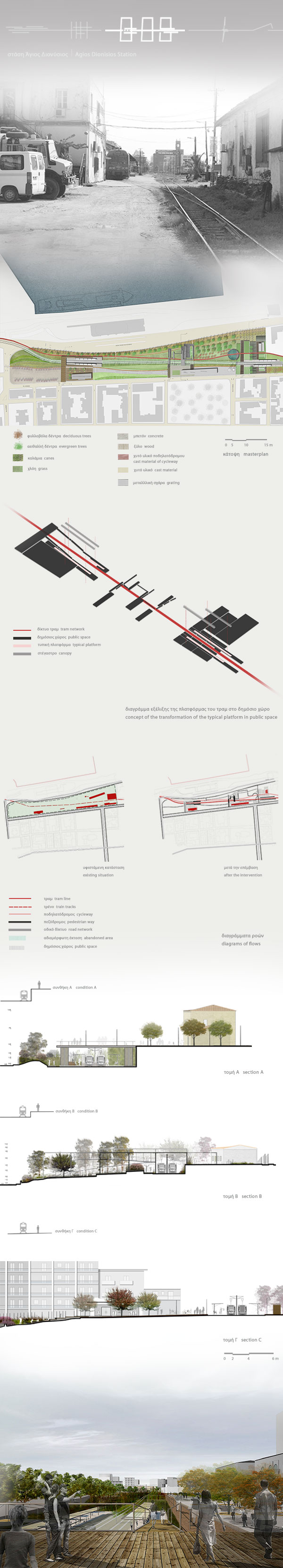
Agios Dionisios Station
By replacing the old railway line with the new tram line, the former fenced train depot is reused as a park. The tram crossing the park diagonally and the existing ground slope separate it into two zones. The main idea is the drilling of the existing boundary enclosing the park and the creation of three squares - "conditions" which "staple" these two zones.
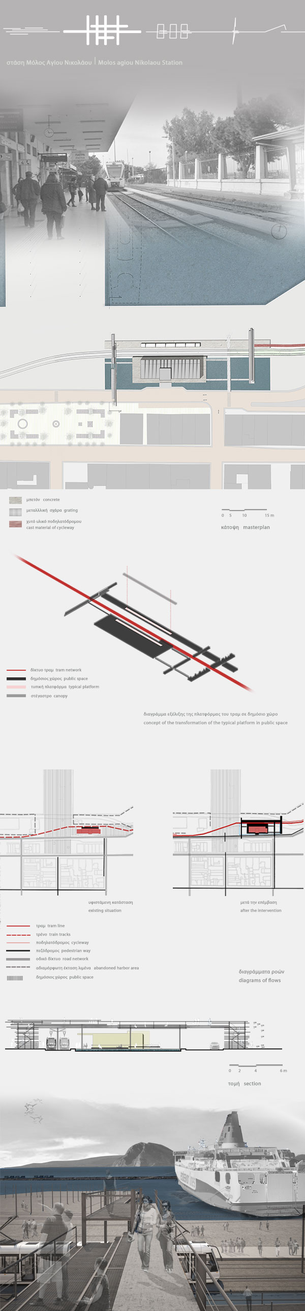
Agiou Nikolaou Mole Station
This station is organized around the existing building of the central train station. Regarding the concept of restoring the city's natural shoreline, the area "floods" and three "bridges - links" are created connecting the urban grid to the waterfront.
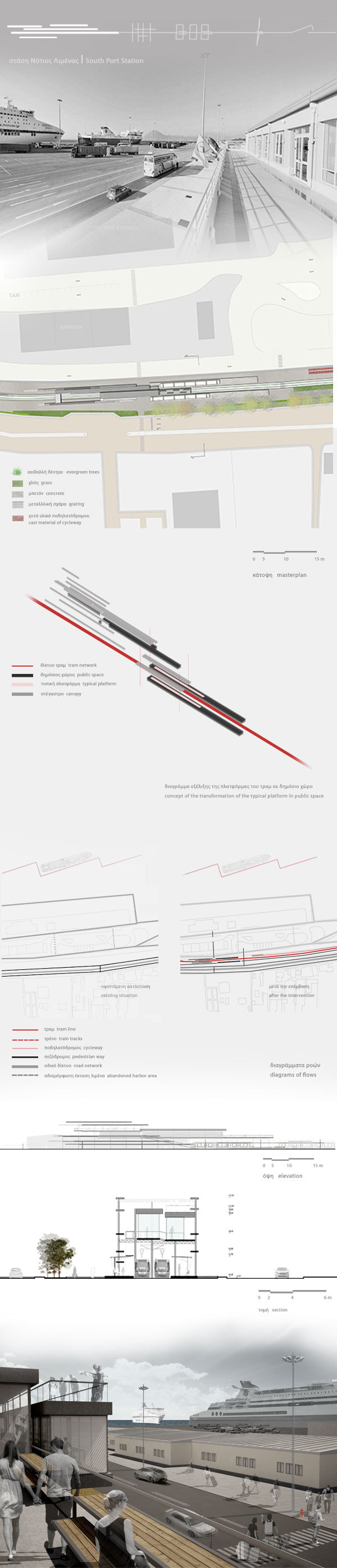
South Port Station
The terminal of the tram line is placed in a linear dead zone between the buildings of the administration of the Port and Akti Dimeon street. The elevated structure evolves into a landmark above the tram line offering a city and port panorama.
Tram is an eco-friendly mean of transportation. The tram line is the opportunity of blurring the boundaries, redefining the correlation between the city, its waterfront and the network infrastructure and creating new public spaces or landmarks.
[1] The "barrier effect" as described in the "Death and Life of Great American Cities", written by Jane Jacobs (American writer and activist). Jacobs, Jane. 1991. The Death and Life of Great American Cities, New York: Random House, Inc.